中国日报 英文版——Underground network aims to forecast earthquakes
By Huang Zhiling and Cao Yin
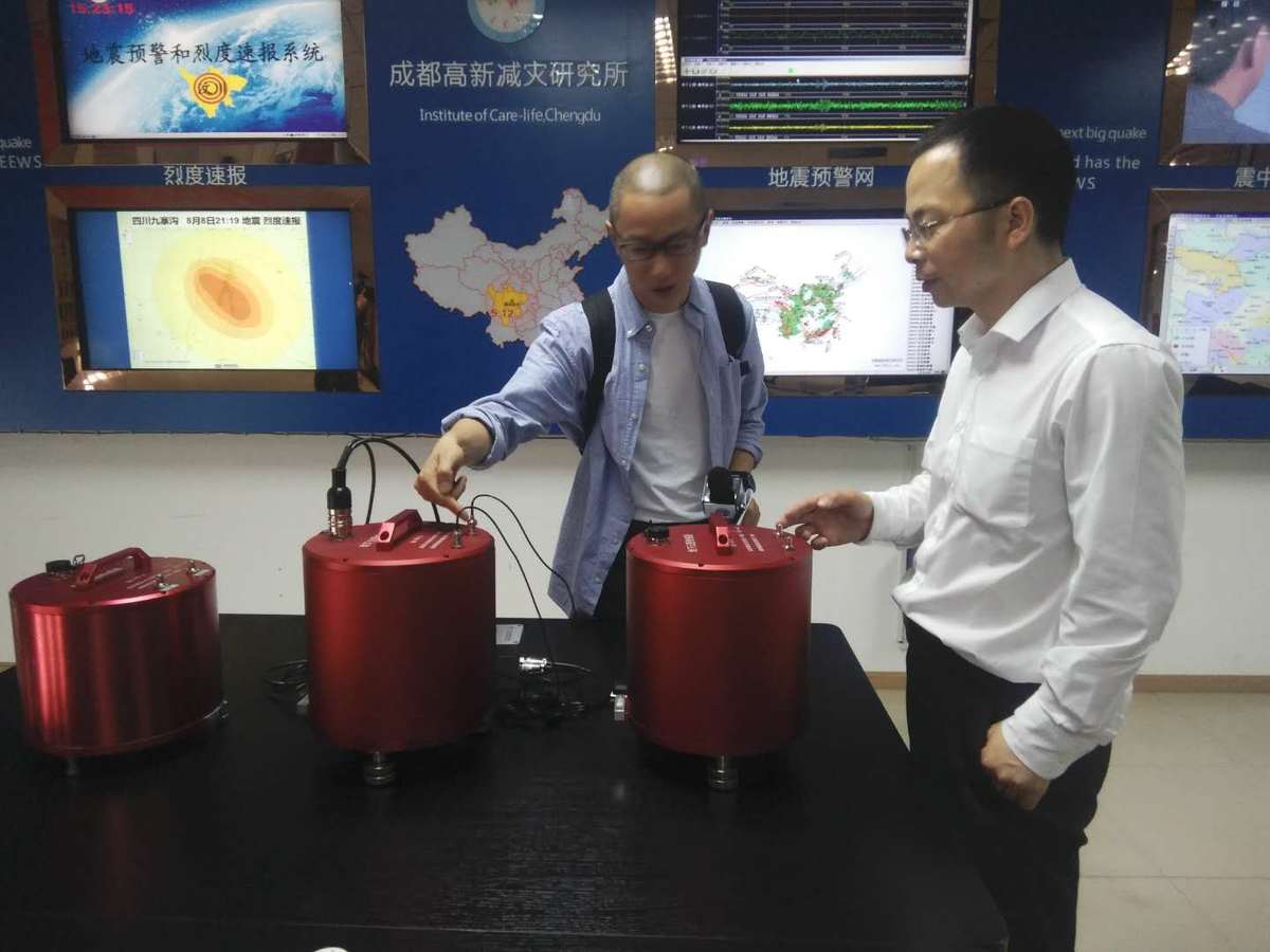
Wang Tun (right), head of the Institute of Care-life, a key earthquake early warning laboratory in Chengdu, capital of Sichuan province, shows the sensors that will be installed for the planned underground cloud map network. [Huang Zhiling/www.chinadaily.com.cn]
China’s first underground cloud map network will be built in Sichuan and neighboring Yunnan provinces, according to the Institute of Care-life, a key earthquake early warning laboratory in Chengdu, capital of Southwest China's Sichuan province.
About 2,000 monitoring stations will be built in the two provinces in one or two years to form an underground cloud map monitoring network.
In the next three years, the institute will rely on data from around 10 destructive earthquakes collected by the underground cloud map monitoring network to explore earthquake prediction, said institute head Wang Tun.
Both Sichuan and neighboring Yunnan province have a high incidence of earthquakes. Each has an annual average of more than three earthquakes above magnitude -5.0. The network can surely collect underground cloud map data on 10 earthquakes within three years, Wang said.
The sensors for about 2,000 monitoring stations will be installed on the surface of the earth to collect data on underground stress and energy eight to 20 kilometers below the surface, providing researchers at the institute with potential insights into earthquake forecasting, Wang said.
"Thanks to the sensors, we do not need to dig holes eight kilometers to less than 20 kilometers deep. Although they are installed on the surface of the earth, the sensors can monitor underground stress and energy eight kilometers to less than 20 kilometers deep," he said.
According to Chen Tianchang, a research fellow with the Sichuan Earthquake Bureau, earthquakes are closely related to underground stress and energy.
The objective of the ambitious project is to successfully predict earthquakes whose epicenters are eight kilometers to less than 20 kilometers deep.
Almost all the destructive earthquakes have taken place within 20 kilometers below the earth's surface, he said. These include the epicenters of the magnitude-6.8 and magnitude-7.2 Xingtai earthquakes in North China's Hebei province in 1966, the magnitude-7.3 Haicheng earthquake in Northeast China's Liaoning province in 1975, the magnitude-7.8 Tangshan earthquake in Hebei province in 1976, the magnitude-8.0 Wenchuan earthquake in Sichuan in 2008 and the magnitude-7.0 Jiuzhaiguou earthquakes in Sichuan in 2017, Wang said.
Earthquakes with epicenters less than eight kilometers deep are generally minor ones below magnitude-5.0, as earthquakes with epicenters that are not deep enough cannot accumulate enormous underground stress or energy, he said.
The first monitoring station of the planned underground cloud map network was installed last week at the Yingxiu Earthquake Station in Wenchuan county in Sichuan.
Yingxiu was the epicenter of the Wenchuan earthquake on May 12, 2008. It killed 69,226 people and left 17,923 missing.
新闻来源:中国日报 英文版 Underground network aims to forecast earthquakes